Monday, 23 April 2012

Camping on Haida Gwaii!


 Photo Credit: Larry Duke 'Kagan Bay Campsite'


Camping on Haida Gwaii is a great way to experience nature at its very best!


Photo Credit: Anvil Cove Charters
Wander amongst the old growth cedars, stroll the sandy beaches... feel the cool ocean spray on your cheeks... run your hands through the sea foam and hear the surf pounding on the beach… this is what memories are made of!

Photo Credit: Brian Eccles
Photo Credit: Ian Gould


Haida Gwaii offers many camping experiences ranging from rugged wilderness camping to Provincial campgrounds or private campgrounds with full hook-ups, a restaurant and a hot shower at the end of the day! You can even rent camping equipment while you are here…but call ahead – camping is a popular activity!

 Photo Credit: Tourism BC

Photo Credit: Heron Weir

Please refer to our Visitor Map  to assist you in locating the various communities on Haida Gwaii. You may also wish to check out community profiles on our GoHaidaGwaii website.

Let’s take a look at some of the campgrounds in close proximity to each of the islands’ communities:

 Photo Credit: North Pacific Seaplanes

Sandspit: (see the Sandspit Community Map)
*Sani-Station and water are available at 501 RV Camping in Sandspit

 Photo Credit: BCEH.com

Photo Credit: Sandspitbc.ca


501 RV/Tent Park 501 Beach Rd 250-637-5473
(Private Campground)
  • Showers, Laundry, Power/Water/Sani-Station, Boat Launch
  • 16 RV and Tenting Sites
  • Ocean Access/Beachcombing

Ministry of Forests/BC Parks Recreational Campsites on Moresby Island:
  • Please be advised that all public camping sites on Moresby Island are accessible only by logging roads. Please check at the Sandspit Visitor Info Centre located at the Sandspit Airport for up to date road and hauling conditions
Photo Credit: 21Mickrange

Gray Bay
(BC Parks Recreation Site)
Located 25km SE of Sandspit
  • 20 sites on beach, group camping site, picnic tables, pit toilets, fire pits, day use shelters, no water
  • Access by logging road / 4-wheel drive recommended 
Photo Credit: Caroline Cournoyer-Galt
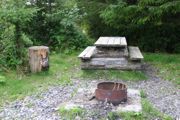
Photo Credit: QueenCharlottesEH.com

Moresby Camp
(BC Forest Recreation Site)
Closest road access to Gwaii Haanas National Park Reserve
  • 6 sites, picnic tables, pit toilets, fire pits, no water
  • Suitable for single or large groups
  • Access by logging road / 4-wheel drive recommended


Queen Charlotte: (see the Queen Charlotte Community Map)
*Sani-Station located on Oceanview Drive adjacent to NAPA Auto Parts


Photo Credit: Jenn Dolen


Joy’s Campground
(Private Campground) 3922 Oceanview Drive, Queen Charlotte 250-559-4666
joys@qcislands.net
  • 2 large RV sites, 3 small camper sites and 6 tenting sites
  • 2 Electrical hook-ups/ No washroom facilities /Close proximity to Public Porta-Potties

The Bunkhouse Campground Resort
(Private Campground)
921 3rd Avenue, Queen Charlotte (206) 259-6013

  • 12 sites on 3 tenting greens
  • 4- 20' x 50' RV sites with water, sewer and 30 amp electrical hookups available
  • 4- car/mini van sites with water and 15 amp electrical hookups available
  • Washroom, shower   

    Haydn Turner Community Campsite
    (Community Campground)
    Follow Oceanview Drive to western end of the village
    • 6 sheltered sites, 3 walk in tent sites on beach,
    • Water, picnic tables, fire pits, dry toilets

     Photo Credit: Larry Duke

    Kagan Bay Campground
    (BC Forest Recreation Site)
    Located 4km west of Queen Charlotte City
    •  6 sites located on the Kagan Bay, picnic tables, pit toilets, fire pits, no water 


    Tlell: (see the Tlell Community Map)

     Photo Credit: Jason Shafto


    Photo Credit: Natural Impressions Photography
    Misty Meadows Campground
    (BC Parks Campground)
    (250) 557-4390 for more information

    Located on Hwy 16 in the community of Tlell
    Near Pesuta Shipwreck Trail & East Coast Trail

    • 30 sheltered sites(10 tent sites), water, picnic tables, fire pits, dry toilets, day use, cooking shelter
    • Ocean access/Beachcombing
    Photo Credit: SATaylor


    Photo Credit: Natural Impressions Photography

     Photo Credit: Ryan Conroy


    Port Clements: (see the Port Clements Community Map)
    *Sani-Station located on Bayview Drive (see the Port Clements Community Map)


    Photo Credit: Ian Gould

     Photo Credit: Kerri Haybittle


    Photo Credit: Ian Gould

    Sunset RV Park & Campground
    (Community Campground) Phone: 250-557-4295

    Located on the east shore of Masset Inlet in Port Clements
    Near Golden Spruce Trail, Haida Canoe
    • 6 RV sites, 4 tent sites, 
    • Hydro, water, picnic tables, dry toilets, cooking shelter, day use picnic shelters


    Masset/Tow Hill: (see the Masset and Tow Hill Community Maps)
    *Sani-Station located at Visitor Info Booth on Highway 16


      Photo Credit: Ian Gould


    Photo Credit: Caroline Cournoyer-Galt


    Hidden Island RV Park 1790 Tow Hill Rd 250-626-5286
    (Private Campground)
    • 16 large private treed lots with/without hookups
    • Large private tent sites available
    • Full hookups (include: highspeed internet, cable TV, telephone, electricity, water and sewer)
    • Restaurant, Heated washrooms, Laundry, Showers, Fishing Charters & Licenses

    Old Beach Road RV Park 1470 Old Beach Rd 250-626-5083
    (Private Campground)
    • 16 sites - water, sewer and electrical

      Photo Credit: Ron Caves


     Photo Credit: Ron Caves


    Agate Beach Campground
    (BC Parks Campground)
    (250) 557-4390 for more information

    Located 23 km east of Masset on Tow Hill Road
    Near Cape Fife Trail, Tow Hill & North Beach
    • 32 ocean front sites(10 tent sites), water, picnic tables, fire pits, dry toilets, day use, cooking shelter
    • Ocean access/Beachcombing 

    Photo Credit: Natural Impressions Photography

     Photo Credit: Ian Gould


    For more information on many of these campgrounds please check out http://www.gohaidagwaii.ca/what-to-do/camping/ , http://www.gohaidagwaii.ca/where-to-stay/camping-rv/ and http://campgroundsofcanada.com/  as well as the Queen Charlotte Visitor Centre

      Photo Credit: Anvil Cove Charters


    Haida Gwaii Tourism has provided a list of campsites on Haida Gwaii. We encourage you as a visitor to research the various facilities prior to your visit as we cannot guarantee the quality of your experience.


      Photo Credit: Anvil Cove Charters
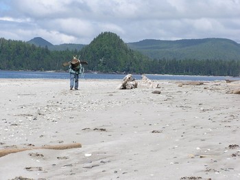
      Photo Credit: Anvil Cove Charters

      Photo Credit: Anvil Cove Charters

    Monday, 16 April 2012

    The Mexican Tom Trail


    Plank road image courtesy of Port Clements Museum (http://www.portclementsmuseum.org/index.htm)


    By Jen Bailey

    As you drive along Highway 16 from Queen Charlotte, you will notice the road hugs the coastline until just past Tlell. There, the highway hooks west into the interior and follows a path nearly arrow-straight, all the way to Port Clements. This part of the highway was affectionately known as the "Mexican Tom Trail".


    In 1904, this route was roughly blazed by Eddie Stevens and William Cood from Stewart Bay (in Masset Inlet) to William Thomas Hodges' ranch at Tlell (now home of the Richardson Ranch). William Thomas was better known as "Mexican Tom", which is a story for another day. Shortly thereafter, LT 'Lucky' Watson came from Masset and followed the same route as Cood & Stevens. Upon reaching Tom's cabin in Tlell, Watson remarked to Tom that "It was some journey...they told me in Masset it was a trail." Tom teased him about naming the route 'Watson's New Trail' and Watson responded, "No, by gosh you don't Tom, because I am giving it to you. From now on its going to be known as Mexican Tom Trail."

    And like so many things said in jest, the name stuck. Although the trail became widely known and used, no one ever heard of Tom using it himself - he preferred traveling by beach (Kathleen Dalzell's "The Queen Charlotte Islands 1774-1966 Vol. 1").

    Surveyed in 1920, the first stage of the highway was built with two 2" by 12" wooden planks - complete with turnouts for passing (on especially difficult sections, the planks were laid side to side instead of end to end). The rule of the road at this time called for the driver closest to the turnout to reverse back - imagine the steady nerves and precision required to avoid falling off the planks and into the muskeg! A car that that floundered off the track tied up traffic until enough wood could be found to rescue it. Shortly thereafter to 'improve' the road, six-inch planks were added to each side. Imagine the heady thrill of achieving a high speed of 20km/hour on these planks! In the 20 odd years of operation, no one was killed or even seriously hurt on this wooden road.

    In 1941, the decision was made to grade the road for gravel, and the old planks were taken up section by section - with the work being completed in 1951. In 1966, the route was paved over and widened to such a degree that would make it unrecognizable to those hardy pioneers who first traversed in in hiking boots.

    Information provided with kind permission from Kathleen Dalzell's "The Queen Charlotte Islands, 1774-1966 Vol. 1", Harbour Publishing (1989 Edition)

    Monday, 9 April 2012

    Kayak Haida Gwaii!


    Photo Credit: Heron Weir/Moresby Explorers


    Haida Gwaii is an exceptional destination for sea kayaking. Experienced kayakers often plan multi-day expeditions into Gwaii Haanas National Park Reserve and Haida Heritage Site; however, even a beginner can experience day trips in Haida Gwaii. 


    Photo Credit: Anvil Cove Charters
     
    The protected waters of Masset Inlet (near Port Clements and Masset) and Skidegate Inlet (near Queen Charlotte, Skidegate and Sandspit) are popular destinations for day trips. Good kayaking locations are easily accessible from each of the Islands communities. 


    Photo Credit: Heron Weir/Moresby Explorers


    The west coast of the islands is extremely rugged and only suited to very experienced kayakers, while the east coast is somewhat more protected. Strong winds and challenging conditions are possible at any time of year. 


     Photo Credit: Anvil Cove Charters

    Kayak and other outdoor equipment rentals or sales are available in the communities of Masset, Sandspit and Queen Charlotte.  BC Ferries permits passengers to store their kayaks on board if they are without a vehicle.


     Photo Credit: Heron Weir/Moresby Explorers

    Approximately seven local experienced and knowledgeable guiding businesses operate from Haida Gwaii offering day and multi-day tours ranging from the protected inlets to South Moresby and the West Coast. Check out our local kayak guiding operators http://www.gohaidagwaii.ca/what-to-do/kayaking/


     Photo Credit: Anvil Cove Charters

    In addition, approximately 20 companies (local and off-islands) provide multi-day guided kayak/mothership tours in Gwaii Haanas National Park Reserve www.pc.gc.ca/pn-np/bc/gwaiihaanas/visit/visit7.aspx
      
     Photo Credit: Heron Weir


    Consider adding a day or multi-day kayak experience to your 2012 visit to Haida Gwaii!

     Photo Credit: Anvil Cove Charters


      Photo Credit: Anvil Cove Charters


      Photo Credit: Anvil Cove Charters


      Photo Credit: Anvil Cove Charters


      Photo Credit: Anvil Cove Charters


      Photo Credit: Heron Weir/Moresby Explorers


      Photo Credit: Anvil Cove Charters

    Monday, 2 April 2012

    March Mapping Madness!


    Our graphic designer, Jen Bailey referred to the final month of the mapping project as March Mapping Madness for understandable reasons! 

    While in the midst of planning for a permanent move to Haida Gwaii (perhaps she drank from St. Mary's Spring?), Jenn worked 'night and day' to redesign our visitor map and create ‘walking tour’ maps of each of the Haida Gwaii communities. The mapping information was compiled by local researchers from each community.


    Photo Credit: Jenn Dolen

    The ‘walking tours’ include a totem pole tour in Old Massett, a nature tour in Masset, an historical tour of Port Clements, beach and parkland tours in Tlell and Tow Hill, a cultural tour of Skidegate and waterfront tours in Queen Charlotte and Sandspit.


    Photo Credit: Ian Gould

    Jen has also provided us with an updated visitor map for Haida Gwaii (beautiful!). On the back of the map you will find local listings for accommodation, land and water charter tours, restaurants and many other services.


     Photo Credit: Jason Shafto


    Photo Credit: Archie Stocker Sr.


    The Guide to Recreation and Trails on Haida Gwaii is a very useful resource for locating hiking/biking/recreational trails and campsites


    Photo Credit: Jenn Dolen


    We encourage you to use these resources for your trip planning - there is so much to do and see!


     Photo Credit:  North Pacific Seaplanes


    Photo Credit: Anvil Cove Charters


     Photo Credit: Heron Weir


    Photo Credit: Anvil Cove Charters